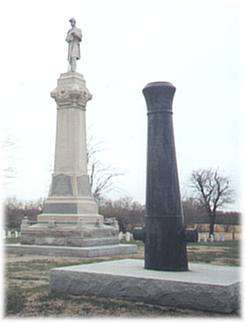
Fort Blair Site
category : Forts
 Baxter Springs was a stopping place on the old Military Road serving Army forts which protected the preCivil War West from "hostile" Indians. It wasn't until 1862 the field camps were built in Baxter to supply troops to escort the wagon trains through the dangerous Indian Territory to Ft. Smith, Arkansas or Ft. Gibson, Cherokee Nation.
 In the Spring a field camp, known as Camp Baxter Strings, was built here by Col. Charles Doubleday's 2nd Ohio Brigade and Col. William Weer's 2nd Kansas Brigade to garrison about 6,000 troops. Col. Weer's troops included two regiments of the Kansas Indian Home Guard. Camp Little Five Mile, built by Col. Richey's Kansas Indians in June 1862, was located to the southeast and across Spring River. Then in May and June of 1863 two more field camps were built here, Camp Joe Hooker, built by Col. James Williams' 1st Kansas Colored Troops, and Camp Ben Butler, built by the same group in June of 1863.
In July of 1863, a decision was made to establish a permanent garrison here, and in August, Lt. John Crites was sent with parts of companies C and D of the 3rd Wisconsin Cavalry to build a fort at Baxter Springs. The fort, officially called Fr. Blair, but commonly referred to as Ft. Baxter consisted of a block house and some log cabins surrounded by breastworks of logs covered on the outside by rocks and earth. It was here that Confederate guerillas under the command of William Clark Quantrill, struck about noon on October 6, 1863, then moved to massacre a contingent of troops being led toward Fort Smith by General James G. Blunt. The dead, for the most part, are buried in Baxter Springs Cemetery, just west of the city.
Address: 7th and Military Avenue (Historic Route 66)
Come visit us in Baxter Springs, Kansas
