LASR.net Homepage


Menu


National Cemetery #2


category : Cemeteries
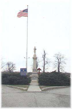
National Cemetery #2 The soldier's plot in this cemetery was designated by the federal government after the Civil War on ground donated by the city for that purpose. It is under the jurisdiction of the National Cemetery Plot in Ft. Scott. The soldier's monument was erected in the spring of 1870 and the bodies of the victims of the attack on the fort and the massacre were reinterred in a common grave. Names of the 88 victims are engraved on the monument. The fence surrounding the plot is made of cannon barrels protruding from the ground. Originally, cannon balls were mounted on each barrel.


Address: 1 mile west of town on Hiway 166

Come visit us in Baxter Springs, Kansas

Attractions and Upcoming Events

Johnston Public Library

The grand old building was entered on the National Register of Historic Places in 1976. Built in 1872, it was intended to be the County Courthouse, but was never used for that purpose. Through the years the building has been a city hall, theater, and college. In 1905

Baxter Springs, KS Historic Buildings

Historic Walking Tour

Walk along the downtown sidewalks on both sides of Military Avenue. Posted on the store fronts of the historic buildings are framed accounts of the original occupants of each store, their dates, and sometimes an account of a particular historical event that took place at that spot.

Baxter Springs, KS Tours

Fort Blair Site

Baxter Springs was a stopping place on the old Military Road serving Army forts which protected the preCivil War West from "hostile" Indians. It wasn't until 1862

Baxter Springs, KS Forts

Black Dog Trail Marker

Located on the grounds of the Historical Museum, the marker commemorates the Black Dog Trail opened in 1803 by Chief Black Dog ( Manka - Chonka) and his band of Osage Indians who had a village nearby where springs once flowed freely.

Baxter Springs, KS Historical Markers

Tri-State Marker

See the Tri-State Marker and be in three states at once! The meeting point of Kansas, Oklahoma, and Missouri is 6 miles east of Baxter Springs on Highway 166/400. Turn south on the small paved road just west of the state line, and continue to the dead end. Built in 1938

Baxter Springs, KS Geographical Markers

Things to do Cemeteries near Baxter Springs, KS

Cemetery

The oldest grave marker in the cemetery is of Mary Frances Crawford. The friends of Historic Girard has placed a new monument...

Coffey County Cemeteries

The Coffey County Museum features a large genealogy library with cemetery listings, obituaries, all county newspapers from 18...

Elk Falls Cemetery

History buffs will find much of interest here. In addition to the graves of Prudence Crandall and her brother Hezekiah, sever...