Benbrook Lake Trails
category : Trails
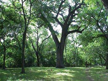
 Fort Worth Trinity Trail - The City of Fort Worth has approximately twenty-five miles of paved hike & bike trails running along the Trinity River and some of its tributaries. The southwestern end of the trail is in Pecan Valley Park near Memorial Oak just north of the Benbrook Lake Dam. This newest section of the trail is quite beautiful with a canopy of trees covering the trail. You can connect from this trail to the river trail that goes northeast to the downtown area and beyond, or to the park roads, US Hwy 377, and State and County roads around Benbrook Lake and in southwest Tarrant County.
Crest of Benbrook Dam - The one and one-half mile (2.4 km) long crest of the Benbrook Lake dam is popular for walkers, joggers and bicyclists. Access is from the gated service road at the east end of the dam, near the Lake Office, with parking nearby at the lake overlook; please do not park anywhere on the service road or block the gate onto the dam.
Although walking on the top of the dam is permitted, please stay off of the grassy downstream slope of the embankment of the dam; walking on the slopes is absolutely not allowed.
Holiday Park Nature Trail and Photo Blind - From behind campsite #1 in the Holiday Park Campground is a foot path that leads to a walk-through gate in the fenceline, and on to a walking Nature Trail. This trail follows open and flat ground. A round-trip hike of 3/4 mile or 1.1 kilometer to the photo blind will take from fifteen to forty minutes; the entire trail is about 1.7 miles or 2.7 kilometers in length. The ground may be wet on the trail and near the photo blind, depending on the lake level and recent weather.
This trail site is a level flood plain with Frio silty clay soils, and lies along the Clear Fork of the Trinity River's north bank on the upper end of the lake. Historically this area would flood several times a year as the river rose after heavy seasonal rains, but only for short periods of time. With the operation of Benbrook dam, floods at this location now often last for several weeks or longer. Record flooding inundated this spot under more than twenty feet of water for ten weeks each year during the spring and summer of 1989 and 1990.
These lengthy floods during consecutive growing season killed the established understory vegetation, as well as many large canopy trees. The vegetation now consists of a more open canopy of large eastern cottonwood and black willow trees, and a recovering understory of box elder trees, scattered buttonbush, evergreen sedges, and early succession annual plants predominated by giant ragweed. You may also notice along the trail, and across the fence in the private agricultural fields to the north, stands of younger cottonwood and willow trees, which germinated as a result of the same extensive floods, just as the mature trees had done years before.
During your walk, keep an eye at your feet for deer track, and an eye above for a roosting barred owl, and broad-winged or red-shouldered hawks. Other bird species you may commonly see along the trail are bluebird, kinglet, woodpecker, and Carolina chickadee. From April through the end of summer, look along the fencelines and in the open parks for kingbirds and scissor-tailed flycatcher. From the photo blind near the lake's normal shoreline, expect to see great blue and other herons, avocets and other migrant shorebirds, pelicans, wintering ducks including wood ducks, bufflehead and hooded mergansers, and even an occasional osprey.
A seven-mile Horseback And Hiking Trail, part of our National Trails System located on the west side of the lake and covers a variety of terrain; the horse trail and associated facilities are currently being expanded and improved.
Enjoy your time at Benbrook Lake; help us protect your resources.
Address: 2.5 miles south of Interstate Highway 20 on US Highway 377
Phone: 817-292-2400
Our Email: ceswf-od-bb@swf02.usace.army.mil
Come visit us in Benbrook Lake, Texas