Lewisville Lake Hiking and Equestrian Trails
category : Trails
 Pilot Knoll Equestrian Trail - Approximately 8 miles
 Pilot Knoll offers several loop trails to explore.
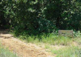
The Pilot Knoll Equestrian Trail is located adjacent to Pilot Knoll Campground and is available to equestrian users and hiking. It is divided into several smaller sub-trails. Although it is located on Corps of Engineers property, it is maintained by the Town of Copper Canyon through an easement with the Corps. The terrain is slightly rolling with several water crossings. Bishop Lane trailhead provides horse trailer parking and Pilot Knoll Park has limited parking outside the main gate for vehicles. There is also walk-in access off of Chinn Chapel Road.
Driving Directions:
To Pilot Knoll Park: From I-35E, take the FM 407/Justin Rd. exit and head west. Turn right onto Chinn Chapel Rd. Chin Chapel ends at Orchid Hill Rd. Turn right on Orchid Hill Rd. Road ends at Pilot Knoll Park.
To Bishop Lane trialhead: From I-35E, take the FM 407/Justin Rd. exit and head west. Turn right onto Chinn Chapel Rd. Chin Chapel ends at Orchid Hill Rd. Turn right on Orchid Hill Rd. Turn left on Bishop Lane. Road ends at trailhead.
Elm Fork Hiking and Equestrian Trail - Approximately 6 miles (2 miles currently Elm Fork Trail offers excellent variation of habitats. Open to horses)
Through the cooperative efforts of the Town of Copper Canyon, the City of Corinth, the Town of Hickory Creek, and the Corps of Engineers, this new trail connects to the the Pilot Knoll Trail and will eventually end at Sycamore Bend Park. Currently, hikers can access the trail from the parking lot at the historic Old Alton Bridge Park. Horses gain access from the Pilot Knoll Trail. The trail is still a work in progress; horses are required to stop after two miles until further trail improvements are made, but the entire 6 miles of trail is open to hikers.
Driving Directions:
To Old Alton Bridge Park: From I-35E, take the Swisher Road exit and head west. Turn left onto Old Alton Road. The park will be approximately 100 yards down the Old Alton Road on the left.
Ray Roberts Greenbelt - Approximately 10 miles
The Greenbelt offers an easy day's ride for both horses and bikers. Horses and bikers are on separate trails.
The Ray Roberts Lake/Lake Lewisville Greenbelt Corridor is multi-use trail system that begins at the Ray Roberts Dam and ends at the headwaters of Lake Lewisville. Equestrians, hikers, bikers, canoeists, birdwatchers, anglers, and other outdoor enthusiasts can access the trail at one of three trailheads, located at FM 455, FM 428 and Hwy. 380. The trail is located on Corps property and maintained by Texas Parks and Wildlife.
Address: North of Dallas on I-35, exit on Justin Rd/407.
Phone: 972-434-1666
Our Email: CESWF-OD-LE@swf02.usace.army.mil
Come visit us in Lewisville Lake, Texas