LASR.net Homepage


Menu

Cimarron National Grassland Trails

Cimarron National Grassland Trails
Cimarron National Grassland TrailsThe Cimarron offers many types of terrain that suits the activity level of most any hiker.
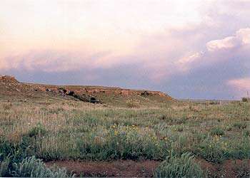
The Companion Trail parallels the Santa Fe National Historic Trail for 19 of the 23 miles of the original trail, the longest potion of the historic trail located on public lands. The Companion Trail closely follows the existing remnants of the Santa Fe Trail from 0 to 150 feet, and consists of a grassy trace across the prairie. Sagebrush and cacti have been removed to make the trail sufficiently evident to the hiker without noticeably altering the prairie vistas. Along segments where the historic Trail is no longer evident due to erosion or agriculture, the Companion Trail overlays the true Trial location. In segments that contain actual Trail remnants or ruts, the Companion Trail is set to the side to preserve and protect the historic Trail.

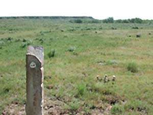
The staff of the USDA Forest Service has marked the archeologically correct route of the Santa Fe Trail as it crosses the Grassland. The Santa Fe Trail served as a primary trade route between Franklin, MO and Santa Fe, NM during the mid-1800\'s. As visitors approach the area of the Trail, they will see old limestone fence posts planted in the ground at intervals; these posts mark the actual path of the Trail. The posts are situated so that viewers can stand at one post and look across the prairie to see the next progressive post along the Trail.

The terrain varies between primarily flat prairie land, occasional draws, and the relatively gradual incline up to and down from Point of Rocks, classified as Easy to Moderate. Each end of the Companion Trail contains a trailhead with parking, unloading, watering, and stock tying facilities, handicapped mounting/dismounting facilities, and restrooms.

Motorized vehicles are not permitted on this trail. Use is limited to bicycle, foot, wheelchair, horse, draft and pack stock, and wagon travel. The trail is not paved, compacted or leveled, and is sandy in some places.

The eastern terminus of the Companion Trail is the Conestoga Trailhead located 3 miles east of the Wilburton Crossing on FS 600 (FS 600 parallels the Cimarron River to the north side), then 2 miles north

Western terminus is the Murphy trailhead, about 7 miles west of highway 27 on FS 600. To reach the Murphy trailhead, take FS 600 west where it crosses highway 27. Follow for approximately 7 miles the trailhead is on the north side of FS 600.

The Turkey Trail is approximately a 10 mile hike beginning at the Cimarron Picnic Area on Highway 27. Named for the large flock of wild turkey present, the trail meanders along the flat-to-rolling terrain along the corridor of the Cimarron River, providing many opportunities for viewing wildlife, particularly birds, different varieties of vegetation and camping.

Opportunities for birdwatching abound along this wooded easy to moderate trail; and the Cimarron Recreation Area, Mallard Pond and Wilburton Pond offer fishing as well. Potable water is available at both the Cottonwood Picnic Ground and the Cimarron Recreation Area. Hikers are advised to carry their own water. Livestock are not permitted within the Cimarron Recreation Area or the Cottonwood Picnic Ground. Camping is available at the Cimarron Recreation Area. Motorized vehicles are permitted on this trail, along with pedestrian, horseback, pack stock, and bicycle travel.

Access is north of Elkhart on Highway 27 at the Cottonwood Picnic Grounds (just south of the Cimarron River Bridge). Vehicles may be parked at the Picnic Grounds. Some visitors choose to pick up the Turkey Trail at the Cimarron Recreation Area, 4 miles east of Highway 27 on FS700 (South River Road). Restrooms are available at the Cottonwood picnic Ground and the Cimarron Recreation Area.

Cimarron National Grassland Tours

Cimarron National Grassland Auto Tour
Cimarron National Grassland Auto TourThe Cimarron National Grassland Auto Tour is a self-guided, 50 mile tour which will take approximately 3 hours to complete. The tour includes 11 stops at unique places and features 6 points of interest. Stops include wildlife, a picnic area, oil production, sand dunes, a prairie dog town and scenic overlooks along the Cimarron River. A companion brochure, available at the District office, contains a map indicating the various stops on the tour, as well as numbered narrative segments which correspond to the stops. This scenic drive is a great way to see the Grassland by car. The roads are good gravel roads, and are accessible to sedans and most RVs, but caution is advised during wet weather as the roads become quite slippery with even small amounts of moisture.
The tour begins at the intersection of Highway 56 and Morton Street (Elkhart\'s main street) and continues throughout the Grassland.

Be sure to pick up your self-guided brochure at the Cimarron National Grassland District Office, the Morton County Museum or download the brochure from the USDA web site.

Cimarron National Grassland Birdwatching

Cimmaron National Grassland Birdwatching
Cimarron National Grassland was named by the American Birding Association as one of the top 100 places in the United States for birding and has been featured in Birder\'s World. At last count, 345 bird species bring people from local areas, regionally and throughout the world. With the assistance of the KS Dept. of Wildlife & Parks, 90 guzzlers and 35 developed areas have been fenced to provide shelter and water for wildlife.

Cimarron National Grassland Camping

Cimarron National Grassland Camping
Camping on the Grassland falls into two categories: established site or primitive dispersed camping.

Established site camping is available at the Cimarron Recreation Area located 4 miles E of Hwy 27 along the gravel road FS700, south of the river. There are 14 sites at this campground, some pull-throughs, with restroom facilties, water shydrants, tables, charcoal grills, stocked fishing ponds, and hiking trails. Most of the facilities at this site are handicapped-accessible, and there is a fishing dock provided for handicapped users. The nightly fee for a campsite is $7.00 and reservations are not available. ONLY charcoal fires and gas camp stoves are permitted in this area, no open campfires. Livestock corrals are located just north of the Recreation area, and are usually available for use, as livestock are not permitted within the Recreation Area

Primitive dispersed camping is permitted anywhere on the Grassland, except in the Cimarron Recreation Area, the Cottonwood & Middle Springs Picnic Grounds and Point of Rocks. There is no fee for this camping.

There is a maximum of 14 days of camping occupancy in any one spot for both primitive dispersed and developed site camping. After 14 days, campers must move their campsite.

Cimarron National Grassland Fishing

Cimarron National Grassland Fishing
Fishing ponds are open year round at the Cimarron National Grassland with light to moderate use. Winters are moderate, with snow common but not usually severe. Summers are hot with dry winds. Trout are stocked in some of the ponds in the winter and channel catfish are stocked during the summer.

Mallard Pond

Travel east of the Recreation Area on FS700 for one mile to a small sign indicating the location of the pond. Facilities are not available.

Wilburton Pond

Travel east past Mallard Pond approximately one mile. Cross the paved road and continue east approximately 1/3 mile to pond on north side of the road. Facilities are not available.

Point of Rocks Ponds

Travel 7 miles north of Elkhart on Highway 27 and turn west on FS600 (just north of the Cimarron River Bridge), continue west approximately one mile; signs indicate the location of the ponds. Facilities include a SST toilet.

Cimarron National Grassland Hunting

Cimarron National Grassland Hunting
Cimarron National Grassland HuntingThe Cimarron National Grassland stretches as far as the eye can see, and is available for public hunting. A major drawing card for hunters is that the Grassland is the largest parcel of public land in the state of Kansas. There are 108,175 acres open for hunting upland birds, small game, varmints, and large game. Hunters often come to the Grassland from all over the United States to hunt one particular species of game, see the diversity of wildlife here, and wind up coming back to hunt another species.

Big game hunting is becoming increasingly popular on the Cimarron National Grassland. Mule deer, whitetail deer, and pronghorn are the big game animals inhabiting the Grassland, while bobwhite and scaled quail, pheasant, lesser prairie chicken and mourning dove make up the upland game bird population. Cottontail rabbit are abundant, and varmint hunting for coyote and prairie dogs is popular.

Hunting for antelope, mule deer, whitetail deer, and turkey hunting requires a valid Kansas hunting license plus a permit obtained from the Kansas Department of Wildlife and Parks on a drawing-type basis.

Hunters often inquire as to where each species of game bird is most commonly found. Naturally, we cannot guarantee that they will find what they are looking for in each of these areas, but a general summary of habitats follows:

Pheasant - grassland adjacent to cultivated private lands.
Bobwhite Quail - fence rows, woody areas along the river.
Scaled Quail - abandoned farmsteads & farm machinery, windmill areas.
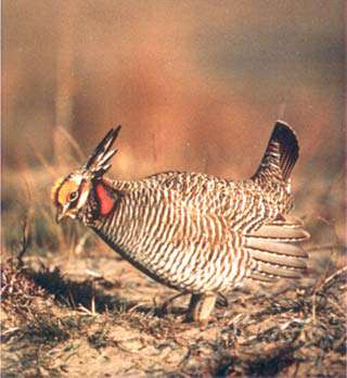
Lesser Prairie-Chicken - grassland adjacent to milo fields ( watch for them flying into/out of fields at dusk and dawn)
Dove - windmill areas.
Deer - primarily within the length of the Cimarron River Corridor, and amid the fields and pastures north of the river and west of State Highway 27.
Turkey - within the Cimarron River Corridor, primarily east of State Highway 27.
The flat terrain of the Cimarron National Grassland makes it especially attractive to physically-challenged hunters. This topography, combined with the numerous oil- and gas-facility roads that provide easy access to virtually every part of the Grassland, make it ideal for use by disabled hunters.

When hunting, be aware that oil and gas facilities have personnel who maintain these facilities daily and may also have high-pressure lines above ground. There are other uses of the Grassland to watch for as well such as grazing cattle. If you see these facilities or cattle down range from where you are shooting, we would encourage you to pick a safer angle or location from which to shoot.

Cimarron National Grassland Wildflowers

Cimarron National Grassland Flora
Cimarron National Grassland FloraFor the majority of the year, the grassland\'s \"at glance\" vegetation consists of a large variety of short to mid-height prairie grasses and forbs, which are extremely interesting to the botanist. But during spring - provided there is sufficient moisture - the prairie comes alive with wildflowers.

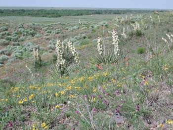
While there is a list of plant species found on the Cimarron National Grassland, those species commonly known as wildflowers have never been specifically listed. Briefly, our wildflower species are primarily those of various cactus species, penstemons and helianthus, but there are many, many others that lend brilliance and interest to the display.

If folks would like to visit the Grassland to view wildflowers, there are a few suggestions to keep in mind. Since the wildflower display depends on the spring rainfall amounts, it is advisable to telephone the office a few weeks prior to the anticipated visit to determine if rainfall has been sufficient to produce blooming. Likewise, if folks are interested in viewing a specific specie, they might contact the office to see if that specie is blooming at the time of visitation.

Park Area Events