LASR.net Homepage


Menu

Big Bend National Park, TX Events

August

20Big Bend Ranch Rodeo Alpine - Local ranch cowboys compete for cash and prizes in bronc riding, team doctoring, wild cow milking, team branding and team penning. Begins at 1 p.m. Ad ... more

September

9 - 11 Marfa Lights Festival Alpine - Includes music, craft and food booths, parades and street dances. Gun and knife show occurs Saturday and Sunday. ... more

10 - 12 Big Bend Balloon Bash Alpine - Hot air balloons ascend each morning above the Alpine Valley. Enjoy family activities on the airport grounds and a spectacular fire-glow concert on th ... more

31West Fest Marathon - Enjoy a cabrito cook-off, washer pitching contests, team roping, children's games and rides, music and entertainment for adults, Saturday night dance ... more

5 - 7 NIRA Alpine - Students from colleges and universities across the Southwest compete in bareback riding, calf roping, steer wrestling, saddle bronc riding, team ropin ... more

October

7Heaven to Hell Ride Alpine - Offers an introduction to the Big Bend for those who do not know its many splendored routes. Takes motorcyclists along 350 miles of mountain trails, f ... more

21Annual Marathon 2 Marathon (M2M) Marathon - Run a marathon in mystical Marathon, Texas. Events include the Marathon, Two-Person Relay, and a 10K fun run. 26.2 miles between Alpine and Marathon! ... more

21M2M (Marathon 2 Marathon) Alpine - Covers 26.2 miles between Alpine and Marathon. E. Hwy. 90. ... more

23Marathon Basin Annual Quilt Show Marathon - Afternoon exhibit in Gage Hotel Courtyard. Judges will award ribbons for 3 places in 15 categories. ... more

5The Haunting of "Contrabando" Presidio - The "Contrabando" movie set is transformed into a haunted ghost town. Includes haunted house, games, refreshments, fortunetellers and ghost stories. H ... more

November

13Cowboy Social and Silent Auction Marathon - Includes live entertainment, food, dance, silent auction and door prizes. Hours are 3 to 6 p.m. Benefits the Marathon Health Center. ... more

14Annual Marathon Marathon Marathon - ... more

14 - 19 Annual Terlingua International Chili Championship Terlingua - Once a year, on the first Sat. in November, some 5,000 "chiliheads" converge on Each year on the first Saturday of November CASI holds the ultimate ce ... more

1 - 2 Gallery Night/Art Walk Alpine - Artists from across the Big Bend region display their work at locations in and around downtown. Includes the ever-popular art car parade, music, food ... more

December

11Fiesta de Noche Buena Marathon - (Marathon Gallery Night) Shops Open, Strolling Musicians, Refreshments, Special Visit by Santa Claus. ... more

Big Bend National Park Hiking

Big Bend National Park Trails
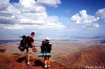
Big Bend National Park TrailsBig Bend National park is a hiker's paradise containing the largest expanse of roadless public lands in Texas. More than 150 miles of trails offer opportunities for day hikes or backpacking trips.

Elevations range from 1,800 feet at the eastern end of Boquillas Canyon to 7,825 feet atop Emory Peak in the Chisos Mountains. These elevation changes produce an exceptional variety of plants, animals, and scenic vistas.

About 30 miles of park trails are developed and heavily used. These include short nature trails and the trails in the Chisos Mountains. Most other trails are primitive, difficult to follow, and in some instances no more than a route up a dry wash.

EAST SIDE OF THE PARK
Panther Junction to Rio Grande Village

Rio Grande Village Nature Trail - 3/4 mile roundtrip

Although a very short and easy trail, the RGV Nature Trail is very scenic and offers fantastic opportunities for wildlife viewing, especially birds. A self-guiding leaflet describes the area's natural and human history. Pick up the trailhead behind RGV campground site #18. After crossing a boardwalk through a spring-fed wetland, the trail gradually ascends a small limestone hill. A side trail leads to the banks of the Rio Grande. From trail's end, hikers are rewarded by a magnificent panorama of the Sierra del Carmen, the river floodplain, Boquillas, Hot Springs Canyon, and the Chisos Mountains. This is probably the best sunset view in the entire park.

Boquillas Canyon - 1.4 miles roundtrip

From the parking area at the end of the Boquillas Canyon Road, the trail climbs over a low limestone hill and drops to the banks of the Rio Grande near some Indian mortar holes. Hikers enjoy great views of the river and mouth of Boquillas Canyon. Further down the trail is a huge pile of wind driven sand below a shallow cave.

Ernst Tinaja - 1.4 miles roundtrip

A short walk up a sandy wash leads to a canyon of highly-convoluted rock layers. The large natural tinaja holds water all year long. Be careful near the tinaja's edge. Over the years deer, javelina, and even mountain lions have been found drowned in this tinaja. The trailhead is located off the Old Ore Road, 5 miles from the southern end near Rio Grande Village. High clearance vehicles are necessary to reach this enjoyable trail. A primitive campsite is located near the trailhead.

Pine Canyon - 4 miles roundtrip

This beautiful hike begins at the very end of the Pine Canyon primitive road. A high-clearance vehicle is necessary to reach the trailhead. The trail gradually climbs through open desert grasslands for one mile before entering the actual canyon. Once in the shelter of the canyon, hikers are rewarded by a shady woodland comprised of Pinyon and Ponderosa pine, oaks, maple, and Texas madrone. The trail ends at the base of a 200-foot cliff that becomes a dramatic waterfall after any rain.

Ore Terminal Trail - 8 miles roundtrip

This strenuous day hike leads through rugged limestone desert following the remains of a 6-mile long ore tramway that once carried ore from the Mexican mines to a large terminal structure in the Ernst Basin. This is NOT a trail to hike during the summer months. This trail begins at the same trailhead as the Marufo Vega Trail. After one mile up the wash, the Ore Terminal Trail veers to the left and heads up the hillside. You will see the remains of the tram towers and cables. The trail ascends the hillside, veers around the head of a deep canyon, and generally follows the tram route to the old wooden tramway terminal in the Ernst Basin. .

Marufo Vega Trail - 14 miles roundtrip

For hikers searching for solitude and a longer loop trip, the Marufo Vega trail provides a strenuous but spectacular journey through the rugged limestone of the Dead Horse Mountains to the banks of the Rio Grande. This trail has NO WATER and is NOT recommended during the summer months when the heat is unbearable. From the trailhead along the Boquillas Canyon road, this trail heads 1 mile up a sandy wash and then turns sharply up a high limestone ridge to the east. After 3 more miles, the trail splits into two forks. The north fork descends for two miles to the Rio Grande. The south fork crosses another high ridge and after 3 miles also descends to the river through a steep 800 foot canyon. Between the two forks, a trail parallels the river from high above.

Be sure to watch for trail markers, carry a good map and plenty of water whenever hiking this rugged yet spectacular trail.

WEST SIDE OF THE PARK
Panther Junction to Castolon

Mule Ears Spring - 3.8 miles roundtrip

This trail starts at the Mule Ears Overlook parking area at milepost 15 on the Ross Maxwell Scenic Drive. Always in sight of the prominent "mule ears" peaks, the trail crosses several arroyos before reaching the spring. A rock corral and cottonwood trees mark the end. Fantastic geology and spring wildflowers make this a delightful day hike.

Santa Elena Canyon - 1.7 miles roundtrip

This trail begins at the end of the Ross Maxwell Scenic Drive. Although a short trail, it is one of the grandest spectacles in the park. After crossing Terlingua Creek, the trail climbs several short switchbacks and then gradually descends along the banks of the Rio Grande. Hikers are surrounded by lush riparian vegetation and 1,500-foot towering vertical cliffs of solid limestone. The trail ends where canyon walls meet the river. Take a lunch and enjoy the scene.

The Chimneys - 4.8 miles roundtrip

A relatively easy hike to a series of prominent volcanic dike formations in the scenic western end of the park. The "chimneys" have always been an important landmark and Indian rock art can be found along the base of these high pinnacles. The trailhead is well-marked along the Ross Maxwell Scenic Drive 1.2 miles south of the Burro Mesa Pour-off spur road. The chimneys are easily seen from the trailhead and can be reached by hiking 2.4 miles. The trail actually continues west for another 4.6 miles to a point near Luna's jacal on the Old Maverick Road. This would be an enjoyable 7 mile hike if you can arrange transportation on the opposite end. From the chimneys you can also head northwest 1.5 miles to the huge cottonwood tree that marks Red Ass Spring. Return the way you came.

Top of Burro Mesa Pour-off - 3.6 miles roundtrip - day use only

An awesome primitive trail that winds through a narrow, rocky gorge to the very top of the Burro Mesa Pouroff. From the trailhead 6.9 miles south on the Ross Maxwell Scenic Drive, the trail gradually descends into the narrow ravine. You will have to scramble over some rocks, but most of the trail is through soft sand. At the end, explore the sandy pothole cave carved by flash floods. A narrow slot in the cave wall is the top of the 100' pouroff. Do not attempt this hike during stormy weather. Make sure you follow the route carefully and return the way you came.

Ward Spring - 3.6 miles roundtrip

A pleasant desert hike leading to a tiny backcountry spring. Enjoy the great desert views and interesting vegetation. The trailhead is along the Ross Maxwell Scenic Drive at mile marker 5.5. From the trailhead you can see where a large volcanic dike dips into the canyon...this is the location of Ward Spring. You may see a hint of green vegetation hinting at its location. This spring was used by the Homer Wilson Ranch and the trail follows an old pipeline. Water is usually present most of the year.

Red Rocks (Blue Creek) Canyon - 3 miles roundtrip

A hike up a large canyon, past an old ranching property, to some of the most colorful rock formations in Big Bend National Park. Begin at the Homer Wilson (Blue Creek) Ranch Overlook, along the Ross Maxwell Scenic Drive. From the trailhead you will see the restored bunkhouse, and up-canyon, some of the "red rocks". The trail takes you up the canyon through soft gravel and sand to a series of highly eroded formations of volcanic tuff. The bright colors of red, pink, and yellow are spectacular. This trail continues to climb steeply up the canyon for 5.7 miles into the High Chisos and Laguna Meadow.

Grapevine Hills - 2.2 miles roundtrip

An easy hike up a sandy wash surrounded by massive boulders. After 1 mile the trail ascends to a low saddle at the end of the drainage. Follow the signs to locate the giant "window" of boulders. This is one of the most picturesque spots in all of Big Bend NP. Kids love this trail! The trailhead is located 7 miles down the Grapevine Hills Primitive Road. Ask a ranger about current road conditions.

CENTER OF THE PARK
Chisos Mountains Trails

The Lost Mine Trail - 5.2 miles roundtrip

This moderately difficult trail begins at mile marker 5 along the Basin Road. With it's accompanying trail guide (available at the trailhead), this is an excellent introduction to the plants and animals of the Chisos Mountains. The trail starts at an elevation of 5,600' and steadily climbs to the top of a 6,850' promontory overlooking Pine and Juniper Canyons. If you don't want to hike the whole way, one of Big Bend's greatest viewpoints is at the end of the first mile. Take a lunch and enjoy the sights and sounds of the High Chisos.

The Window Trail - 4 miles roundtrip

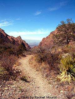
This trail begins from the Basin Campground near site #52. This trail is unique in Big Bend in that it descends 800 feet from the trailhead for two miles. Hikers then must gradually ascend on the way back. The first mile is through open scrub vegetation with fantastic views of surrounding Chisos peaks. The last mile enters a cool shady canyon with oaks, wildflowers, and a sometimes a trickle of water. At the end of the trail is the "window"...the pour-off that drains the entire Chisos Basin. It is a narrow slot in the canyon wall at the top of a 100 foot dropoff. This trail is a good one for viewing wildlife. Hikers frequently see javelina, gray fox, and sometimes even black bears. For an extra treat, take the Oak Spring Trail which veers off near the end of the Window Trail. Take this side trail for 1/4 mile to a point above the actual window. The panoramic view from this high vantage point is spectacular.

Emory Peak - 9 miles roundtrip

This is a 9 mile roundtrip hike to the highest point in Big Bend National Park (7,825'). The last 25 feet require a scramble up a sheer rock wall, but your reward is the ultimate panoramic view! From the Basin Trailhead take the Pinnacles trail for 3.5 miles. At this point, the one mile trail to the summit cuts off and heads upward. For fantastic views and solitude, this trail is hard to beat! Most hikers require approximately 5-6 hours for the roundtrip journey.

The South Rim - 14 miles roundtrip

The South Rim is located at the extreme southern edge of the Chisos Mountains. At the rim, the desert floor lies 2,500 feet below you and vast panoramas of rugged desert and mountains beckon far into Mexico. The South Rim can be done as a strenuous day hike, but is best enjoyed on a 1-2 night backpack trip. Backcountry campsites are available with a backcountry permit. Hikers may make a great loop by taking the Pinnacles Trail up and the Laguna Meadows Trail down, or vice versa.

NORTH END OF THE PARK
Panther Junction to Persimmon Gap

Dog Canyon - 4 miles roundtrip

This medium-difficulty trail offers a glimpse into a narrow canyon cut between massive layers of limestone. Begin this hike from the park road 3.5 miles south of the Persimmon Gap visitor center. Look for the roadside exhibit. Dog Canyon is clearly visible, yet 2 miles away. Follow the cairned trail toward the canyon. After 1.5 miles, the trail enters a wash. Turn left and follow the wash directly into Dog Canyon. Return the way you came. This hike can be very hot, especially during the summer months...be sure to bring water and a hat.

Devil's Den - 6 miles roundtrip

Explore a dramatic limestone slot canyon in the northern backcountry of Big Bend NP. Begin this hike from the park road 3.5 miles south of the Persimmon Gap visitor center. Look for the roadside exhibit. Devil's Den can be seen as a narrow cut across the mountainside to the south of Dog Canyon. Follow the cairned trail towards Dog Canyon. After 1.5 miles the trail enters a wash. Turn right here and follow the wash. After another 1/2 mile, take the large wash that intersects from the left. This will take you directly into Devil's Den. Adventurous hikers may hike into the Den for about 1/2 mile. Numerous potholes sometimes hold water. For the best views and best adventure, exit the wash at the entrance of the "Den" and follow the trail to the top along the southern edge of the deep crevice. You can then enter the den and hike back through it. Try not to get wet in the numerous small pouroffs and tinajas!

RUGGED AND REMOTE
Into the wildest places of Big Bend NP

The Mesa de Anguila

Rugged, primitive, hard to access, and spectacular
Situated along the far western boundary of Big Bend National Park, the Mesa de Anguila is rarely visited by park visitors. The mesa forms the right hand (U.S.) side of Santa Elena Canyon. It is a high uplift that extends well into Mexico. This area is for experienced hikers/backpackers only. The 7.5 minute USGS topographic map of the Mesa is essential, as are good map reading skills. The various trails are primitive and sometimes hard to follow. Water is always a problem on the mesa. Although there are several tinajas, they are frequently dry. What the Mesa de Anguila does offer is unsurpassed solitude, spectacular vistas, and magnificent desert wildness. Stop by park headquarters for more information on how to access the mesa and suggested routes.

The Outer Mountain Loop (Dodson) Trail - 30 miles roundtrip

A STRENUOUS, yet potentially very rewarding journey through some of the most rugged, remote, and beautiful landscapes of Big Bend National Park. Definitely not a hike for everybody, but for those who are prepared, an unforgettable adventure.
click here to learn more...
Map, photos, suggested itinerary, precautions, etc...

Mariscal Rim Trail - 6.6 miles roundtrip

The drive to the trailhead is long and dusty, but once you begin to hike, the spectacular views of the Rio Grande and superlative cliff walls of Mariscal Canyon will make it all worthwhile. This trail begins at the end of the Talley Road via the River Road. It will take you at least 2 hours of driving on rough dirt roads to reach the small parking area that denotes the trailhead. There are four primitive roadside campsites located along the Talley Road. Be sure to have plenty of water with you, because this hike is hot and there is NO shade anywhere along the way. The first 1.5 mile is easy and level, but the last 1.8 miles is extremely steep as it climbs straight up to the top of Mariscal Canyon. The views here are unsurpassed, and the sheer drop-off will challenge your senses.
Click here for a trail map...

Note: This trail is closed from February 1 - July 15 each year
to protect the falcons that nest on these cliffs.

Big Bend National Park Camping

Big Bend Camping
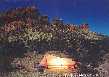
Big Bend CampingMost campsites in Big Bend National Park are on a first-come, first-served basis with no advance reservations. The National Park Service operates 3 campgrounds at Rio Grande Village, the Chisos Basin, and Castolon. The cost is $10.00 per night for a site.

A limited number of campsites in Rio Grande Village and the Chisos Basin campgrounds will be reservable from November 15 to April 15 each year. Reservations may be made up to 240 days in advance by visiting www.reserveusa.com or by calling 1-877-444-6777. Big Bend National Park cannot make reservations.

Camping is also available at primitive backcountry campsites in the Chisos Mountains and along backcountry roads. High clearance or 4-wheel drive vehicles are necessary to reach most road sites. Big Bend's unpaved roads are generally unsuitable for RVs and trailers (check current conditions with a ranger). Overnight camping in any of the primitive road sites requires a backcountry use permit, obtained in person at park visitor centers up to 24 hours in advance.

Camping areas are often full during the Thanksgiving and Christmas holidays, as well as during spring break in March or April. The only public showers and laundry facilities in the park are located at the Rio Grande Village store. The Village store is open daily and offers groceries, gas, a laundromat, and coin operated showers. There is no food service at Rio Grande Village.Rio Grande Village RV Park

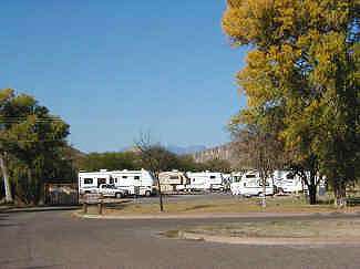
The only hookups available in Big Bend National Park are at Rio Grande Village in the 25-site full-hookup campground operated by National Park Concessions, Inc. The hookups provide water, sewer, and electricity. You must have a three-inch sewer connection to stay at the RV area. Register at the store. No advance reservations are taken. The cost is $18.00 per night for a site.

Near the RV park is the 100-site Rio Grande Village Campground operated by the National Park Service. Although there are no hookups, water and flush toilets are available. Set in a large grove of cottonwoods, the campground is adjacent to the Rio Grande. Many of the sites are pull-throughs. Generator use is limited to 8:00 a.m. to 8:00 p.m. daily. A no-generator use area is also designated. Each site has a picnic table and grill (for charcoal only--wood fires are not permitted). Some sites have ramadas and all are located within walking distance of restrooms and water spigots. An RV dump station is available. Campsite #14 and the adjacent restroom are fully accessible for wheelchair users. During busy periods, the accessible campsite will be held until 6 p.m. and will then be released

Reservations for 43 sites in the Rio Grande Village Campground may be made for dates between November 15 to April 15. Contact www.reserveusa.com or by calling 1-877-444-6777.

The 65-site Chisos Basin Campground is rugged and hilly. The sites are small and most are not suited to recreational vehicles or trailers. The road to the Basin is steep and curvy, especially at Panther Pass—the road's highest point. The road into the campground is a 15 percent grade. Trailers longer than 20 feet and RVs longer than 24 feet are not recommended.

Each site has a picnic table and grill (for charcoal only--wood fires are not permitted). Some sites have ramadas and all sites are located within walking distance of restrooms and water spigots. An RV dump station is available. Campsite #36 and the adjacent restroom are fully accessible for wheelchair users. During busy periods, the accessible campsite will be held until 6 p.m. and will then be released for general use. Generators may be used between 8am to 8pm. There is also a "no-generator" section for tenters.

The Chisos Basin Visitor Center is open daily and offers information, exhibits, book sales, and an interactive touch-screen video system. Backcountry use permits are available. The Chisos Basin store is open daily and offers groceries and supplies. A U.S. Postal Service station is located in the store.

Reservations can be made for 26 sites in the Chisos Basin campground for dates between November 15 to April 15. Contact www.reserveusa.com or by calling 1-877-444-6777.

Cottonwood Campground, near Castolon Historic District, is located near the Rio Grande. The campground has pit toilets and potable water, but no hookups or dump station. The use of generators is not allowed in Cottonwood Campground. Each site has a picnic table and grill (for charcoal only--wood fires are not permitted). The historic La Harmonia Store in the Castolon Historic District is open daily and offers groceries and supplies.

Big Bend National Park Equestrian

Big Bend Equestrian Use
Big Bend Equestrian UseVisitors to the park are welcome to bring and use personally owned livestock as long as they understand and abide by the rules and regulations governing the use of livestock. A day use permit is required for all stock use and may be obtained at any visitor center, free of charge.

All gravel roads are open to horse riders. Horses are not permitted upon the paved roads or the shoulders of the paved roads. Cross country horse travel is permitted throughout the park, except for the Chisos Mountains area. Horse use in the Chisos Mountains is limited to the Laguna Meadow Trail, the Southwest Rim to the junction with the Boot Canyon Trail, and the Blue Creek Trail.

Horses are not permitted on the interpretive nature trails in the park since they were only designed for foot travel. The short trails into Santa Elena and Boquillas Canyons are also restricted to pedestrians only. The Pine Canyon Trail in the Pine Canyon Designated Natural Research Area is closed to horses.

Horses are not permitted in developed campgrounds, picnic areas, near eating or sleeping facilities or other areas of concentrated visitor use. All areas of domestic water supply or other sanitation facilities are closed to horses.

Horses may not be taken into Mexico and brought back into the United States without proper authorization from the United States Department of Agriculture.

Backcountry riders must provide controlled overnight maintenance of their animals, including the provision of commercial feed. Grazing within the park is not allowed. Water must generally be hauled to the stock in the lower elevations of the park, where a semi-desert climate prevails. Stock may be watered at the Rio Grande and springs that are not utilized for domestic water supply. Check with park rangers for spring water flows in various areas of the park.

Areas of quicksand may be encountered along the streams, washes, and the Rio Grande. Desert vegetation such as lechuguilla and cactus can injure livestock.

Overnight camping with horses is permitted in several backcountry campsites located on unimproved gravel roads which may be inaccessible to horse trailers. See website for list. Check at a visitor center for current road conditions.

Corrals are available at Government Springs Campsite. Water is not available at the spring trough. It must be hauled to the corral. Watering at the spring itself is not allowed.

Big Bend National Park Boating

Big Bend National Park Boating
Big Bend National Park BoatingThe Rio Grande, or El Rio Bravo del Norte, borders Big Bend National Park for 118 miles. A 1978 Act created the Rio Grande Wild and Scenic River and charged the National Park Service to care for an additional 127 miles downstream from the park. Providing protection and maintaining the pristine character of the Rio Grande along this stretch, the Wild and Scenic River designation actually begins at the Coahuila/Chihuahua, Mexico, state border upstream from Mariscal Canyon and continues downstream 196 miles to the Terrell/Val Verde County line in Texas; approximately 69 miles of this designation lie within Big Bend National Park. Both the Rio Grande Wild and Scenic River and the river along the park's boundary are managed for recreation and preservation by the National Park Service.

Three options are available if you desire to make a river trip: you can bring your own equipment, rent equipment, or hire a guide service that will provide all permits, food, equipment, and shuttles.

Motorized watercraft used within the park is limited to conventional boats with up to 60 horsepower inboard or outboard motors. Jet skis are not allowed in the park.

Gas-powered motorized watercraft will be prohibited on the following sections of the Rio Grande River:
o Santa Elena Canyon, from the western park boundary to the Santa Elena Canyon take-out
o Boquillas Canyon, from the entrance of Boquillas Canyon to the eastern boundary of the park.

Gas-powered motorized watercraft will be prohibited on the following section of the Rio Grande River except for the month of October:
o Mariscal Canyon, from Talley to Solis.

CANYON TRIPS

Colorado CanyonB
Although this canyon lies within Big Bend Ranch State Park and is administered by the Texas Parks and Wildlife Department, it is included here because of the many requests for a relatively easy, one-day trip. This float can vary from nine to 21 miles depending on put-in and take-out points. The most popular section is from the Colorado Canyon put-in to the Madera Canyon take-out on Highway 170, a river distance of nine miles; floating on to Lajitas makes the run a total of 21 miles. Colorado Canyon is cut through igneous rock, unlike the three major park canyons, which are cut through limestone. This trip offers some fun rapids of Class II and Class III. Permits are available and user fees may be paid at the Barton Warnock Center (432-424-3327) in Lajitas or at the west entrance to Big Bend Ranch State Park at Fort Leaton (432-229-3613). Self-registration is also possible at both locations.

Santa Elena Canyon
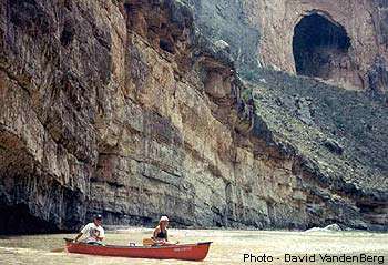
A 20 mile, one to three day trip begins at Lajitas and ends one mile downstream from the mouth of Santa Elena Canyon. For the last seven miles the river is confined between sheer limestone walls that rise as much as 1,500 feet above the river. The Rock Slide rapid is located within two miles of the canyon entrance and is the major hazard for rafters and canoeists. At certain water levels, the Rock Slide becomes a Class IV rapid. Scouting this rapid before running it is essential. Prior to beginning your river trip, consult a Park Ranger about current conditions. Click here for some nice photos of Santa Elena Canyon.

Mariscal Canyon
A 10 mile, one day trip begins at Talley and ends at Solis Landing. Access to the put-in is rough and not recommended for ordinary automobile traffic. Consult a Park Ranger about road conditions before you finalize plans. Mariscal Canyon, six miles long with walls exceeding 1,400 feet, is spectacular. The rapids in the canyon are Class II-III.

Note: Theft of property left in vehicles is not uncommon at Talley, Solis, or the Santa Elena Canyon take-out. Remove valuables from vehicle. Storage lockers are not available in the park.

Boquillas Canyon
A 33 mile, two to three day trip begins at Rio Grande Village and ends at La Linda, Mexico. The Heath Canyon take-out is located on the U.S. side of the river, just downstream of the La Linda bridge. Permission to take-out at Heath Canyon should be obtained by calling Andy Kurie at (432) 376-2235.

Boquillas Canyon is the longest canyon trip in Big Bend National Park, and its walls rise 1,200 feet above the river. Since no rapids rate higher than Class II, this is an ideal trip for those with less experience. Strong headwinds are common. Click here for some nice photos of Boquillas canyon.

The Lower Canyons
A five to 10 day float trip, the journey through the Lower Canyons offers a true wilderness experience. The trip begins at La Linda and ends at either Dryden Crossing (83 miles) or Foster's Ranch (119 miles), which is at the end of the Rio Grande Wild and Scenic River. Some river runners continue to Langtry (137 miles). If that is your chosen take-out, be sure to portage the dangerous weir at Foster's Ranch. The Black Gap Wildlife Management Area does not allow put-ins for Lower Canyons trips.

Permission to take-out at Dryden Crossing should be obtained by calling Dudley Harrison at (432) 345-2403 or 345-2503. Permission to take-out at Foster's Ranch should be obtained by calling (432) 291-3232.

The terrain along the Lower Canyons is open desert, rugged hills, and deep canyons. Access to the river is difficult below La Linda and most of the land above the riverbank is privately owned. The rapids in the Lower Canyons are Class II-V. Click here for some nice photos of the Lower Canyons.

Big Bend National Park Rappelling

Big Bend National Park Rappelling
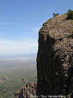
Big Bend National Park RappellingBig Bend National Park is not typically considered a climbers' destination, but it offers some scenic, challenging, and wildly varied rock climbs. Over the years, park visitors have often inquired about climbing, but there is little written.

Climbing in the park is unofficially discouraged because there is little written information to disseminate, the quality of rock ranges from fair to terrifying, the weather can be extremely harsh, and the approaches can be long, waterless ordeals. Bolting of any kind, electric or hand, is strictly forbidden. Climbing in Big Bend National Park can be very rewarding, but leaving any trace of impact on this resource, over time, will surely jeopardize access.

The majority of the park's exposed vertical rock is composed of unstable igneous rock (rhyolite) and sharply fluted limestone. River canyon routes, Dog Canyon, and Mesa de Anguila routes are generally composed of limestone. Routes in the Chisos, Grapevine Hills, and Pine Canyon are generally composed of igneous rock. Don't let this discourage you too much; there are relatively solid climbs on igneous rock. As stated by Roger Sigland in his informal guide, "On any climb expect rotten rock and few good cracks for pitons."

Topographic maps and trail guides are available at the Panther Junction Visitor Center.

Big Bend National Park Birdwatching

Big Bend National Park Birdwatching
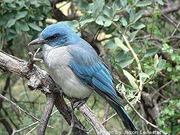
Big Bend National Park BirdwatchingBig Bend National Park is a birdwatcher's paradise. It is home to about 450 species of birds, more than any other national park in the United States.
Visit the website for specie lists, warbles, rare birds, and Big Bend's "Most Wanted."

Park Area Events