Big Basin Prairie Preserve
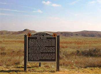
The Kansas Historical Marker stands within a geological feature known as the Big Basin, which is a sinkhole or “sink” about a mile in diameter and more than a hundred feet deep. Although it has the appearance of a valley, it is entirely surrounded by higher ground. Like several other smaller sinks in this section of Kansas, Big Basin was formed thousands of years ago by dissolving and collapse of massive gypsum and salt formations lying several hundred feet below the surface.
Highway 283 bisects the Big Basin traversing 1.04 miles through the basin before climbing to the rim, which has nearly vertical walls. The entrance to the Big Basin Prairie Preserve lies in the bottom of the basin, which is home to a free roaming buffalo herd. Visitors are urged follow the unimproved road to St. Jacob’s Well, but to use caution when exiting their vehicles as these animals are unpredictable.
Approximately two-thirds of the basin lies east of the road within the confines of the preserve. The remaining western third of the basin is privately owned.
Getting There & Details
- Address
- 15 miles south of Minneola on Highway 283
- Map
- Get Directions →
More Things to Do
St. Jacob’s Well
St. Jacob's Well was a welcome spot in this arid area for early explorers and…
Learn more →Clark County Lake
Clark County Lake is nestled in a rugged area of Clark County southeast of Minneola.…
Learn more →Tim’s Diner
Tim's Diner is a simple stop at the intersection where food and refreshment reveals a…
Learn more →