Chouteau National Hiking Trail
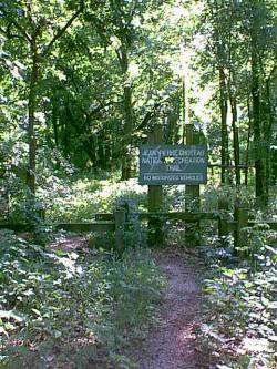
The Jean Pierre Chouteau National Hiking Trail stretches from River Park to the Port of Catoosa along the Grand, Arkansas and Verdigris Rivers. It is located alongside the McClellan-Kerr Arkansas River Navigation Channel.
The trail is approximately 60 miles in length. Six public use areas with camping and picnicking facilities are located at various points on the trail. Camping is allowed in designated areas and by primitive permit in remote areas. Portions of the trail are also designated as an equestrian trail and hikers should be aware that they may encounter trail riders.
Getting There & Details
- Phone
- 918-489-5541
- Map
- Get Directions →
More Things to Do
1903 Building
This interesting building is located on the corner of south Lee across from the Fort…
Learn more →Fort Gibson Dam
Surrounded by high bluffs, with the expansive lake on one side and rushing river on…
Learn more →Cherokee National Cemetery
The Cherokee National Cemetery is a National Historic Landmark maintained by the Cherokee Nation from…
Learn more →First Presbyterian Church and Fort Gibson Bell
The bell located adjacent to the First Presbyterian Church was orginally used in the church…
Learn more →